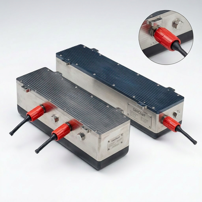
GeoChart X240 is a subsea broadband multibeam echosounder built for deep-sea survey and tight integration on underwater vehicles. Electronics and transducer arrays share compact pressure housings, removing the high-frequency watertight cabling that links a separate electronics bottle to the arrays in conventional split systems. Fewer cables means fewer failure points at depth, and a payload that suits AUVs and ROVs where internal volume, weight and hydrodynamics are at a premium.
Broadband piezo-composite arrays tune continuously from 200 to 400 kHz, so the operator chooses per task: 400 kHz for 0.5° imaging of near-bottom structures, or 200 kHz for a wider swath in deep water and to step away from same-frequency interference. With up to 1,024 dynamically formed beams and real-time beam stabilization, GeoChart delivers 3D bathymetry, seabed imagery and water-column data to IHO S-44 Special Order.

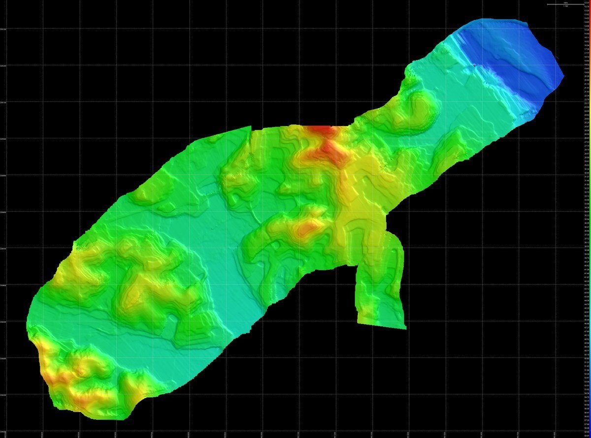
3D terrain model from multibeam bathymetry

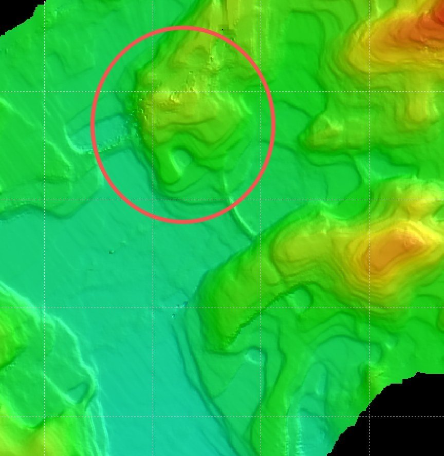
Target detection on multibeam bathymetry (annotated example)

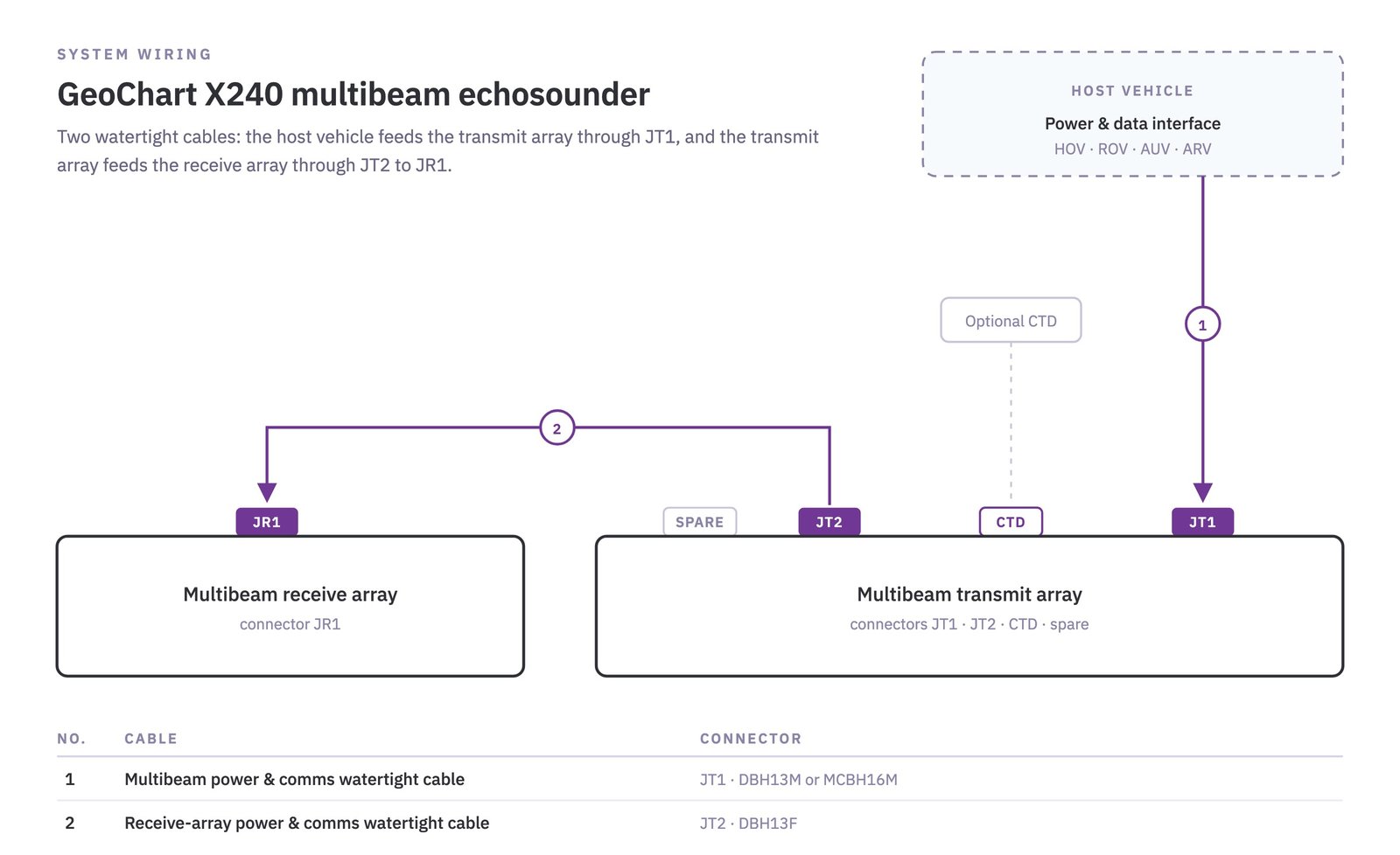
GeoChart system wiring diagram
| Technical Specifications | ||
|---|---|---|
| Number of Beams | Up to 1,024 | |
| Operating Frequency | 200 – 400 kHz | |
| Pulse Length | 50 μs – 10 ms | |
| Ping Rate | 10 Hz @ 70 m | |
| Operating Range | 400 m | |
| Transmit Sector | 150° | |
| Swath Width | ≥5× altitude (at 40 m altitude) | |
| Across-track Resolution | 0.5° | |
| Along-track Resolution | 0.5° | |
| Beam Stabilization | Pitch and roll | |
| Depth Accuracy | Meets IHO S-44 Special Order | |
| Triggering | Internal / external | |
| Data Output | Standard XTF; AUV mode supported | |
| Temperature | −3 to +40 °C operating (in water); −10 to +55 °C storage | |
| Physical Specifications | GeoChart 4240 | GeoChart 6240 |
| Max. Working Depth* | 4,500 m | 6,000 m |
| Power Supply | 48 VDC | |
| Power Consumption | 65 W average; 160 W peak (transmit) | |
| Communication | Gigabit Ethernet (sonar and sensor data) | |
| External Interface | External trigger input | |
| Transmit Array (L × W × H) | 450 × 120 × 155 mm | 450 × 120 × 170 mm |
| Transmit Array Weight (air / water) | 23 kg / 16 kg | 26 kg / 18 kg |
| Receive Array (L × W × H) | 480 × 115 × 90 mm | 500 × 120 × 105 mm |
| Receive Array Weight (air / water) | 20 kg / 13 kg | 22 kg / 15 kg |
Dimensions exclude connectors. Width including cover plate: transmit array 146 mm; receive array 141 mm (4240) / 146 mm (6240).
* An 11,000 m full-ocean-depth version (GeoChart 11240) is available on request.