GeoTexture X155 Subsea Bathymetric Side-scan Sonar

GeoTexture X155 Subsea Bathymetric Side‑scan Sonar

150 / 550 kHz · 6,000 / 11,000 m

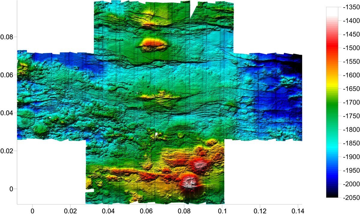
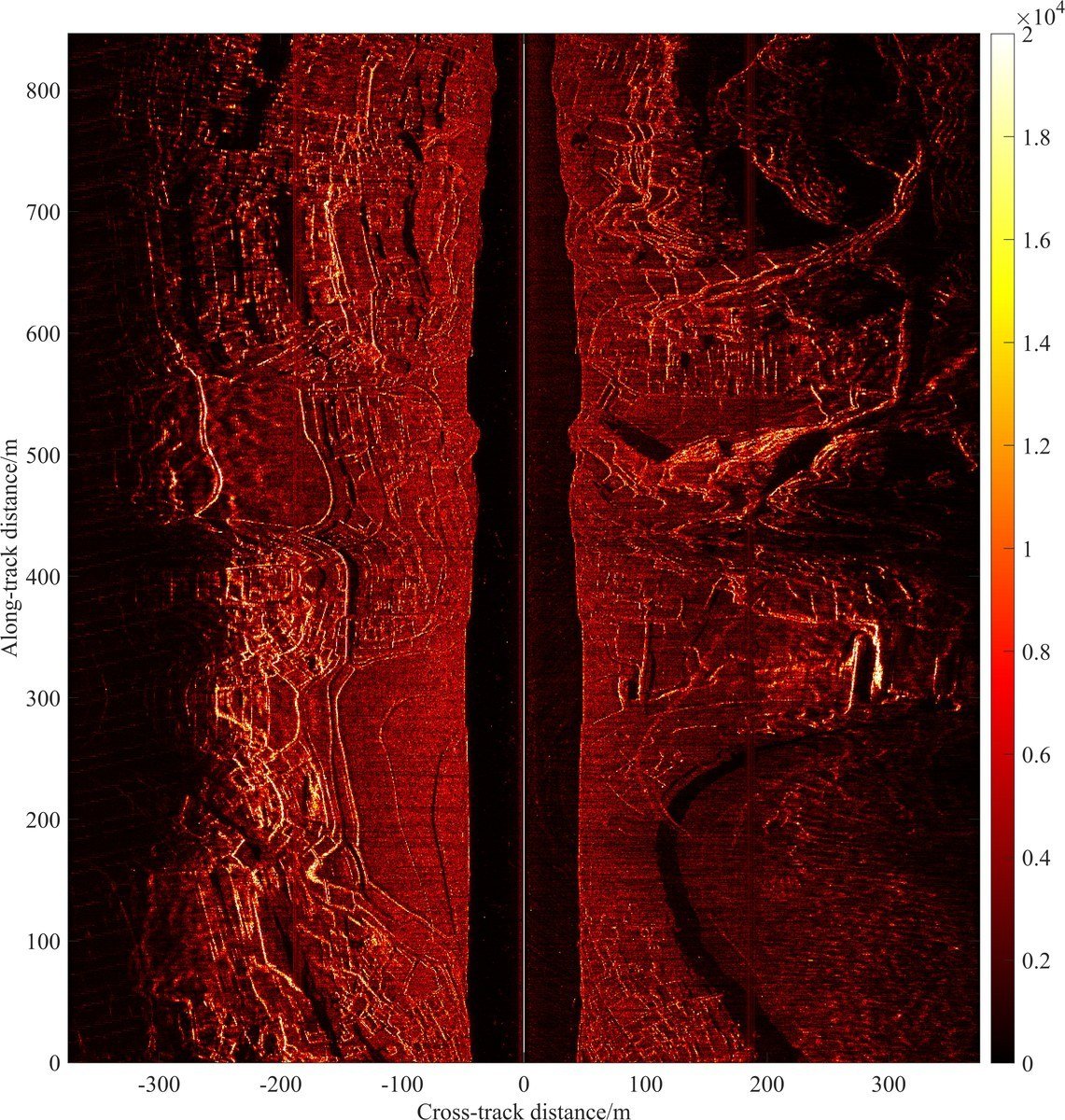
  • Imagery and bathymetry in one pass — Phase processing across sub-arrays delivers dual-sided imagery and full-swath 3D bathymetry together.
  • Rated to 6,000 m — Terrain mapping and buried-target discrimination in deep water; an 11,000 m version is available.
  • Dual frequency, 150 / 550 kHz — 750 m total swath at 150 kHz; ≤1.5 cm across-track resolution at 550 kHz.
  • Ready for SAS — The standard 1 m array has a hardware upgrade path to synthetic aperture side-scan.
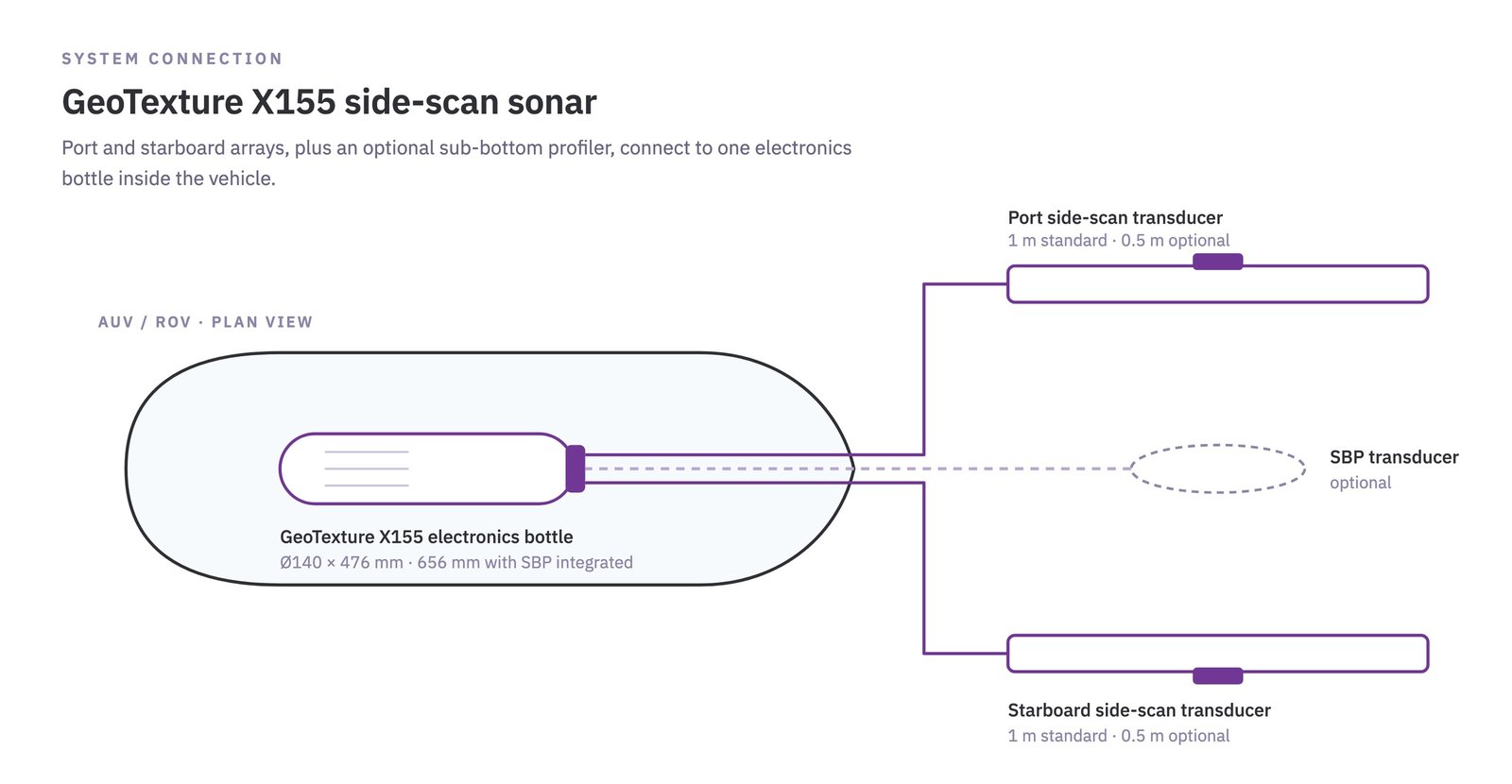
  • Optional integrated SBP — A sub-bottom profiler fits inside the electronics bottle — seabed surface and sub-surface data from one payload.
  • Two transducer lengths — 1 m standard, 0.5 m optional, to match vehicle volume and buoyancy trim.
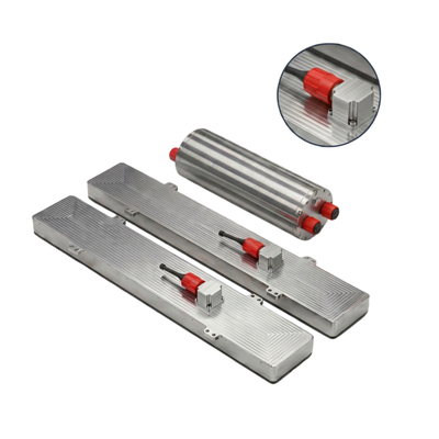
GeoTexture X155 is a subsea bathymetric side-scan sonar for wide-area deep-sea mapping and detailed target investigation. Its interferometric architecture resolves phase differences across multiple receive sub-arrays, so every pass yields both high-resolution side-scan imagery and a 3D bathymetric point cloud — where a conventional side-scan returns a 2D image only.

A 1 m solid-state array is standard, running at 150 kHz and 550 kHz with CW or Chirp pulses: long range at the low frequency, fine seabed texture at the high one. The electronics bottle can host an integrated sub-bottom profiler, and the hardware is provisioned for an upgrade to synthetic aperture sonar (SAS). A half-metre transducer option suits vehicles with tighter payload and trim limits.

3D bathymetry from the interferometric receive arrays

3D bathymetry from the interferometric receive arrays

Dual-sided side-scan imagery

Dual-sided side-scan imagery

GeoTexture system connection diagram

GeoTexture system connection diagram

Applications

Abyssal geological exploration and large-scale 3D terrain modelling
Deep-water pipeline and trans-ocean cable route survey and inspection
Wreck search, underwater archaeology, reef and shallow-buried obstacle survey
Deep-sea mineral resource assessment and seabed sediment classification
Wide-area autonomous survey on AUV / ROV
Technical Specifications
Max. Working Depth*6,000 m
Operating Frequency150 kHz / 550 kHz (dual frequency)
Pulse TypeCW / Chirp
Side-scan Across-track Resolution≤3.5 cm @ 150 kHz; ≤1.5 cm @ 550 kHz
Side-scan Along-track Beamwidth0.8° @ 150 kHz; 0.3° @ 550 kHz
Side-scan Swath (both sides)750 m @ 150 kHz; 200 m @ 550 kHz
Bathymetry Swath (both sides)250 m @ 150 kHz
TriggeringInternal / external
Temperature−3 to +40 °C operating (in water); −10 to +55 °C storage
Physical Specifications
Power Supply46 – 50 VDC
Power Consumption75 W average; 200 W peak (transmit)
CommunicationGigabit Ethernet
External InterfaceExternal trigger input
ConnectorMCBH21M
Electronics BottleØ140 × 476 mm (758 mm incl. connectors), without SBP
Ø140 × 656 mm (938 mm incl. connectors), with SBP
Electronics Bottle Weight18 kg in air / 10 kg in water
Transducer (1 m standard)1,048 × 118 × 101 mm
Transducer Weight (1 m)26 kg in air / 19 kg in water
Transducer Option0.5 m shortened version for compact payload bays

* An 11,000 m full-ocean-depth version is available on request.

Copyright © 2026 Ocean Physics Technology All rights reserved.