Marine Survey Solution/Underwater Lasers
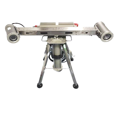
LaserScope 3D Subsea Laser Scanning System
- High accuracy and long range
- Depth rating of 400m, 3000m or 6000m available
- 5m or 10m range available
- Compact and can be integrated into a wide range of underwater platforms
- P&T as standard, various depth rating available, can be integrated for different projects
- Real-time imaging and xyz cloud for timely decision-making
Underwater Lasers
Overview
The LaserScope 3D Subsea Laser Scanning system developed by Ocean Physics is based on the principle of structured light 3D imaging, and can be used to scan seafloor topography or underwater structures at close range by using a tripod for bottom observation or an integrated ROV.
The system can acquire video images carrying 3D information of the target, pre-process the video images, and perform algorithms such as light bar extraction, processing and point cloud conversion to obtain 3D point cloud data of the target surface. At present, it has been applied to a number of users, and has completed the underwater field scanning of different landforms such as underwater flat sandy slope area, large carbonate crusted rocky area and flat sedimentation area.
Application:
- Pipeline Survey and Measurement
- Wind farm monitoring and maintenance
- High-precision scanning and mapping of topography and geomorphology
- Underwater archaeological survey
- Oil and gas underwater structure inspection
- Inspection of harbours, dams, wharves, etc.
- MCM mine detection
- Large ship hull inspection

LaserScope integrated on the skid of one Working Class ROV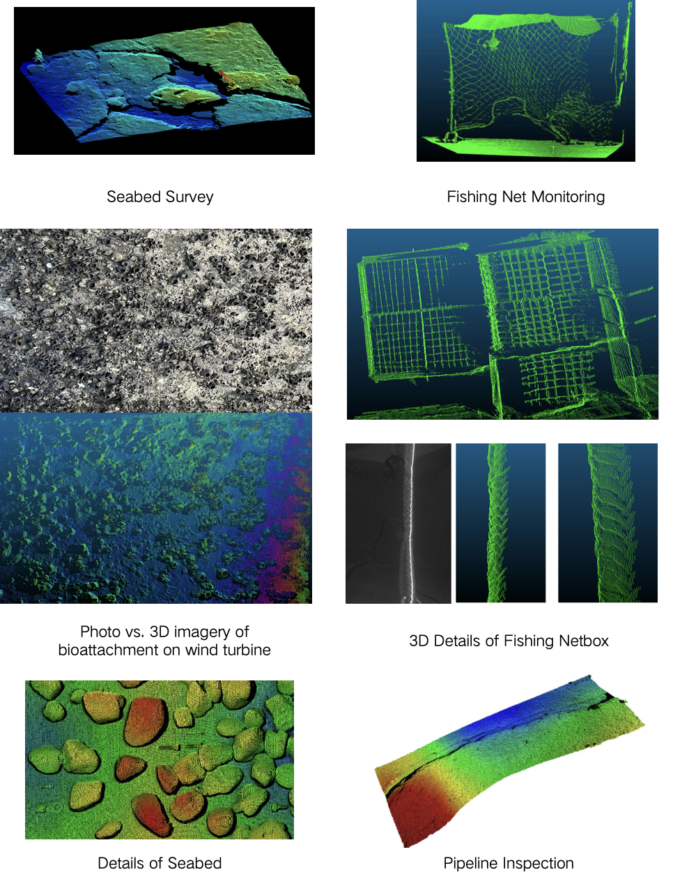
Specifications
Technical data
Specifications | LS-5 | LS-10 |
Scan Range | 0.5-5m | 1.5-10m |
Points per line | 2048 | 2048 |
Angle of laser line | 50° | 50° |
X-axis Resolution( AlongTrack) | 1.7mm@0.25 knots、4mm@0.5 knots、15mm@1knot | |
Y-axis Resolution( AcrossTrack) | 0.5mm@0.5m 1mm@1.5m 2mm@2.5m | 2mm@3m 3mm@5m 5mm@10m |
Z-axis( Vertical) | 0.7mm@0.5m 3mm@1.5m 5mm@2.5m | 0.5mm@3m 1mm@5m 2mm@10m |
Laser | 0-700mW adjustable | |
Wavelength | 450nm | |
Laser Class | 3B | |
Power Input | 9~36VDC/24W | |
Power Consumption | Less than 35W | |
Communication | Gigabit Ethernet, TCP/IP | |
Depth Rating | 400m | 3000m (6000m optional) |
Weight | 5.5 kg in air 2.5kg in water | 12 kg in air 7.5 kg in water |
Data output | Real-time video image & xyz point cloud | |
Adjustable parameters | The system provides 8 adjustable parameters to fully adapt to different underwater working conditions. | |
System Configuration | The system includes camera, laser, underwater Pan & Tilt, access to external calls to C++ API to raw data | |
Pan & Tilt | Torque: 40Nm, Rotation Angle: 360°, Angular Resolution: 0.045°, Power Consumption: 7W, Depth Rating: 400/3000/6000 metres | |
Discuss LaserScope 3D Subsea Laser Scanning System for your project
Tell us about your vessel, water depth and deliverables, and our engineers will recommend a configuration.