Marine Survey Solution/Cable Locators
EML-3X Subsea EM Locator System
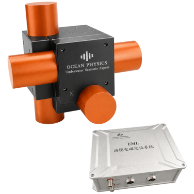
Three-axis EM subsea cable locator
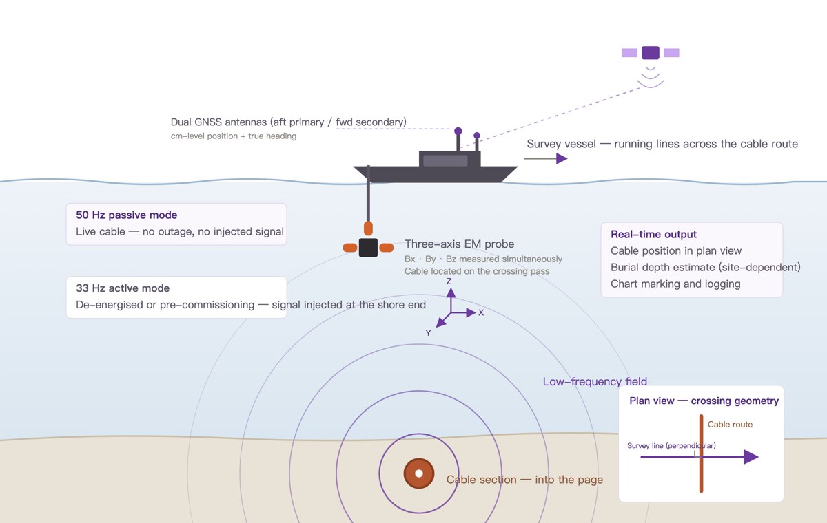
- Three-axis sensing — An orthogonal low-frequency probe records X, Y and Z magnetic-field components during cable crossings.
- Passive and active modes — Survey energised power cables at 50/60 Hz, or use a shore-injected tracking signal for active detection.
- Integrated survey positioning — The acquisition unit includes dual-antenna GNSS RTK for vessel position and true heading.
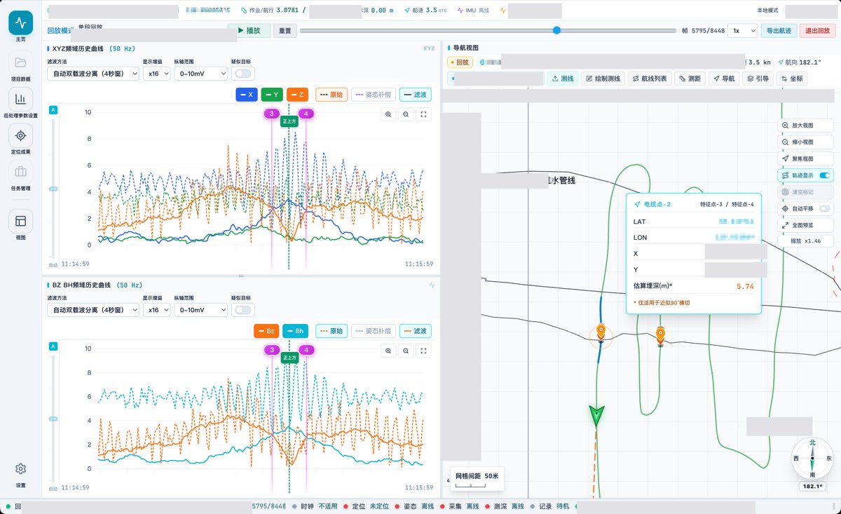
- CableDetect workflow — Navigate, monitor waveforms, review candidate crossings, confirm cable positions and export survey results.
- Condition-dependent depth estimates — Estimate burial depth where signal quality and crossing geometry support interpretation; review results against site conditions.
Cable Locators
Overview
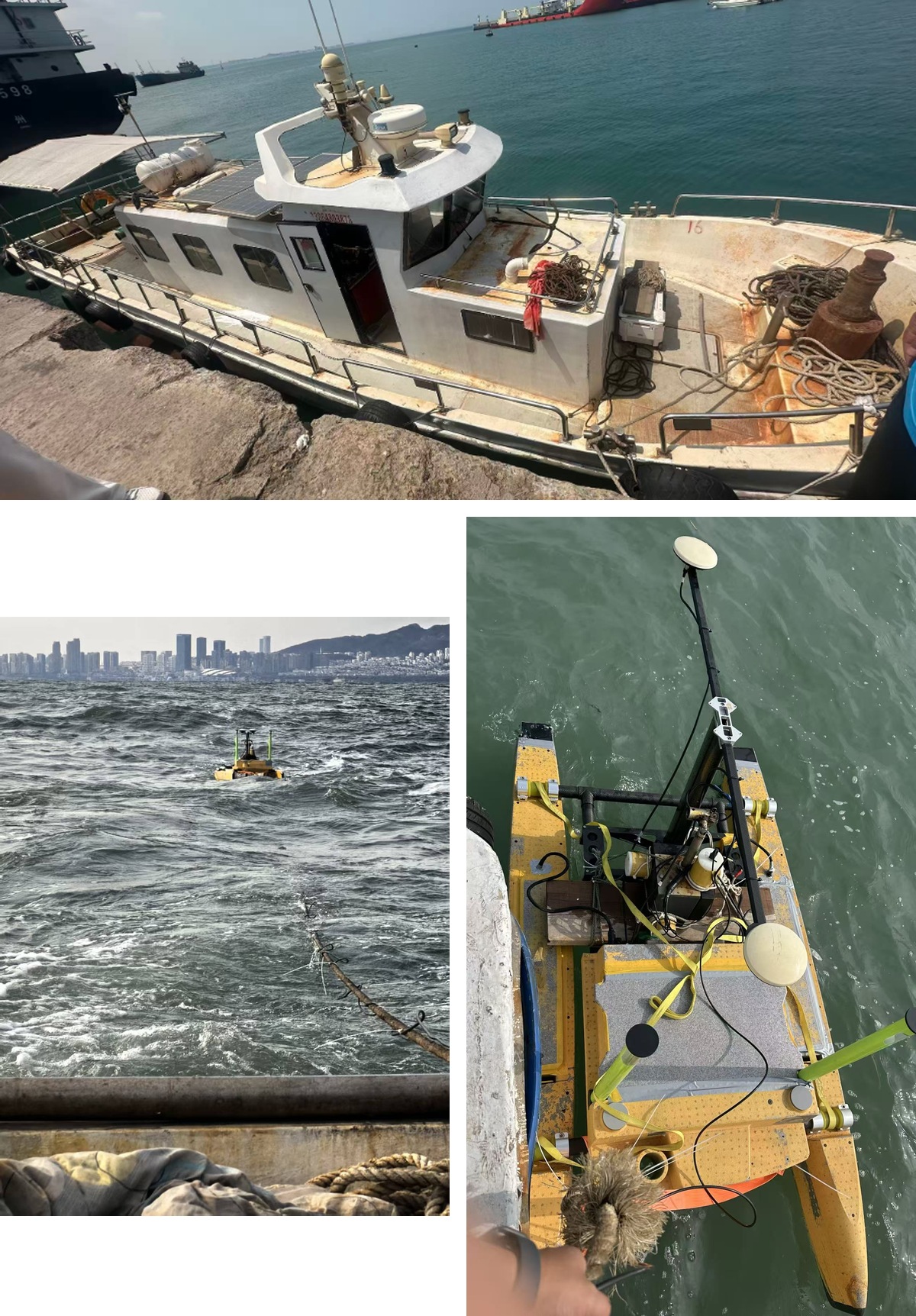
EML-3X is a three-axis electromagnetic subsea cable locator for cable-position surveys in shallow coastal waters, harbours and navigation channels. It combines an orthogonal low-frequency EM probe, an acquisition and processing unit with dual-antenna GNSS RTK, and CableDetect software. The standard arrangement uses an over-the-side probe mount on a surface survey platform.
Passive mode detects the power-frequency magnetic field of an energised cable. Active mode uses a low-frequency signal injected at the shore end of a suitable cable circuit, with 33 Hz as a typical operating frequency. Survey lines cross the cable route to record magnetic-field features and identify cable positions.
CableDetect supports navigation, waveform monitoring, candidate review, manual confirmation and export. Cable positions and vessel tracks can be displayed on an electronic chart; CAD base maps and planned survey lines can be imported, and RAW records can be reprocessed offline. Burial-depth estimation depends on signal conditions and crossing geometry.
Applications
- Cable route verification and maintenance surveys
- Cable-position confirmation ahead of repair work
- Active surveys of suitable de-energised or uncommissioned cables
- Combined survey work with GeoScope sub-bottom profilers
Specifications
Technical data
| Parameter | Specification |
|---|---|
| Passive detection | 50 / 60 Hz power frequency |
| Active detection | 20–60 Hz; 33 Hz typical; shore-end signal injection |
| Probe | Three-axis orthogonal low-frequency EM probe |
| Probe weight | 20 kg |
| Standard mounting | Over-the-side mount for surface operations |
| Positioning and heading | Built-in dual-antenna GNSS RTK |
| External input | GNSS / INS / single-beam echo sounder via NMEA-0183 |
| Acquisition unit dimensions | 210 × 155 × 85 mm |
| Acquisition unit weight | Approximately 3 kg |
| Acquisition unit protection | IP67 |
| Power | 19–24 V DC, 5 A |
| Communication | Gigabit Ethernet |
| Cable | 10 m standard; custom lengths available |
| Operating system | Windows 10 / 11, 64-bit |
| Coordinate systems | WGS84 / CGCS2000; UTM / Gauss-Krüger |
| Recommended survey speed | 4–6 kn, with 75–90° cable crossings |
| Burial-depth estimation | Subject to signal conditions and crossing geometry; no fixed depth or accuracy rating specified |
Proven in the field
Case studies
Discuss EML-3X Subsea EM Locator System for your project
Tell us about your vessel, water depth and deliverables, and our engineers will recommend a configuration.